Science
ETH Zurich tests radar drone to predict Alpine landslides
Researchers at ETH Zurich are testing a radar-equipped drone that can measure glacier movement and help identify landslides and rockfalls before they occur. The technology is being trialled in Valais as thawing permafrost increases Alpine hazard risks.
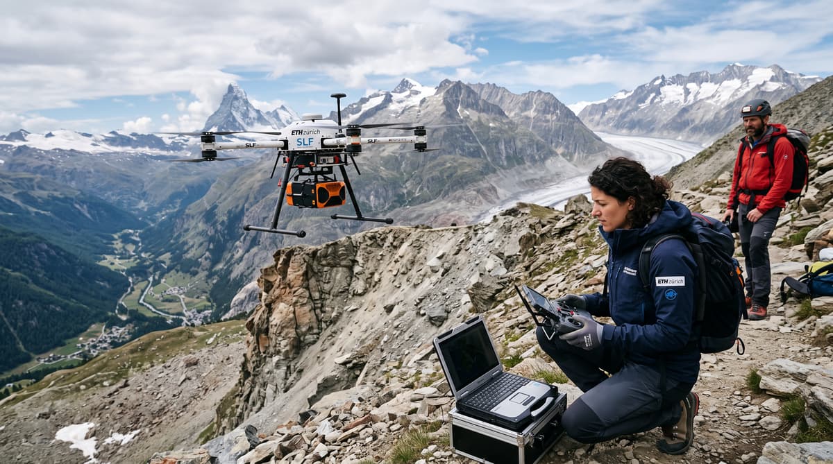
A drone is scanning the Oigschtchummun glacier as thawing permafrost raises the importance of tracking Alpine movement. In the Lötschental valley in Valais, researchers from ETH Zurich are testing a radar-equipped aircraft above Blatten. Its instrument sends electromagnetic waves towards the terrain and records movement that could help identify areas at risk of landslides or rockfalls.
The test targets a glacier that is already moving and is regularly monitored. That gives the researchers existing measurements to compare with the drone’s readings. The first flights have been promising, according to Felix Seidel, managing director of Swiss Geolab, which is involved in the work.
The aim is to make hazard monitoring more precise. A landslide or rockfall can involve changes in a slope or glacier that researchers want to detect before those changes lead to a larger event. The drone is still being tested, but the approach could add a close-up view to Switzerland’s monitoring of unstable terrain.
In a mountain region where thawing permafrost is making surveillance increasingly important, the trial is focused on whether repeated radar scans can reliably capture movement on the ground.
Measure movement in minutes
Repeat scans can reveal movement within minutes. The radar drone records the glacier’s position, then researchers can measure it again and compare the readings. Seidel said the team can see a small difference when it measures the glacier again 20 minutes later, showing that movement can be captured over a short interval.
Those readings matter because they can be checked against regular monitoring data from the Oigschtchummun glacier. Researchers selected the site in part because its movement is already being tracked. Comparing the drone’s measurements with established observations helps them assess how accurately the radar captures changes.
The trial is testing a measurement tool, not announcing a finished forecasting system. To help predict hazards, movement data must be dependable and useful to the people responsible for monitoring terrain. The first flights have been promising, Seidel said, and the comparison with existing data is part of establishing what the drone can contribute.
For now, the focus is on observing and measuring change. A clearer picture of how a glacier or slope moves could help researchers identify places that need closer attention, including areas where landslides or rockfalls may pose a risk.
Pair broad surveillance with close-ups
Radar offers a way to collect measurements when clouds limit laser surveys. Lasers are normally used to detect rock movement, but Seidel said radar can scan through clouds, conditions that make laser measurement difficult. That capability could give researchers another way to observe terrain in the changeable weather of the Alps.
The drone is one part of a broader monitoring approach. Swiss Geolab also supports satellite surveillance, which can regularly observe large areas of the Alpine region. Satellites can help flag locations for closer inspection, but they do not provide the same detail on steep slopes or rock faces.
Seidel described the next step as sending a drone to examine a specific face or valley slope identified for closer attention. Researchers are also considering using drones to place sensors in the terrain. Those sensors could support more precise and continuous tracking of movement.
The methods serve different purposes: satellites can cover wide areas, while a drone can focus on selected terrain. Combining broad surveillance with close-up measurements could help researchers decide where to gather more information. The current flights are testing whether radar can deliver useful readings in that more detailed role.