weather
Thousands of lightning strikes batter Switzerland overnight
Nearly 12,000 lightning strikes and wind gusts exceeding 100 kilometres per hour hit Switzerland overnight. The article should report the immediate disruption and damage picture, explain why the storm was so intense, and assess whether increasingly volatile weather is challenging local emergency planning.
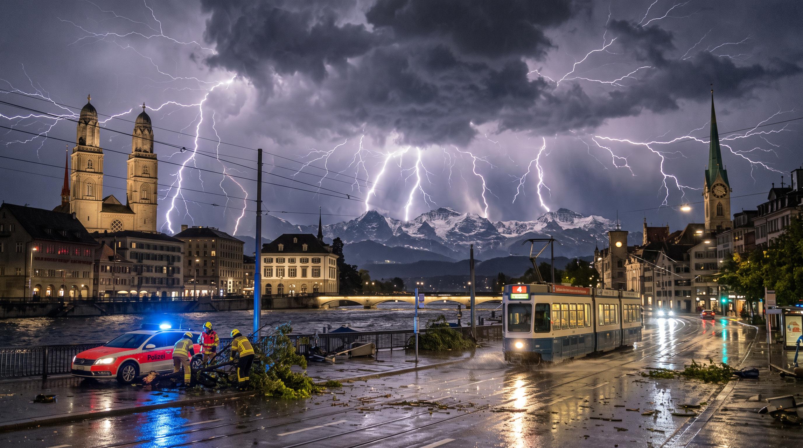
Lightning lights up the country
Nearly 12,000 lightning strikes crossed Switzerland overnight, placing the storm among the most lightning active days ever recorded in the country. MeteoSwiss counted the strikes by Wednesday morning, September 9, 2026, after thunderstorms moved across large parts of the country.
The electrical activity came with powerful winds. The strongest reported gust reached 116 kilometres per hour on the Hörnli in canton Zurich. MeteoSwiss measured 110 km/h in Steckborn, Thurgau, and 101 km/h in Koppigen, Bern.
Those readings show that the storm affected both elevated terrain and lower-lying communities. Lightning detection data captures the scale of the atmospheric activity, while the wind measurements indicate the force felt at ground level. Together, they describe a night that tested weather warning systems across several regions.
The immediate damage picture remained limited in the first hours. As of early Wednesday morning, authorities had reported no damage. That assessment could change as municipalities, transport operators and emergency services inspect roads, power infrastructure, buildings and wooded areas in daylight. For residents, the first priority was safety during the storm, followed by checking local alerts and avoiding exposed areas where fallen branches or damaged cables may pose risks.
Gusts top 100 km/h in three cantons
116 km/h on the Hörnli was the highest wind reading cited by MeteoSwiss, with major gusts also recorded in Thurgau and Bern. The distribution matters because it shows that the storm's strongest winds were not confined to a single valley or urban area.
Steckborn, on Lake Constance, recorded a gust of 110 km/h. Koppigen in canton Bern reached 101 km/h. On the Hörnli, a prominent high point in canton Zurich, the wind climbed to 116 km/h. These readings reflect short, peak gusts rather than sustained wind speeds, but they provide a clear measure of the storm's intensity at selected monitoring stations.
The lightning count adds another dimension. MeteoSwiss recorded nearly 12,000 strikes by Wednesday morning, enough to rank the event among the most lightning active September days in the historical record. Switzerland's geography can produce sharp local differences in storm exposure, particularly between lakes, plateaus and mountain terrain.
The source report does not identify one specific meteorological trigger for the outbreak. Its intensity is established by the concentration of lightning and the simultaneous high gusts. Further MeteoSwiss analysis would be needed to explain the storm's precise development and track.
Emergency crews begin the daylight check
No damage had been reported by early Wednesday morning, a crucial but provisional sign after a night of severe weather. Lightning can disrupt electricity networks, communications and rail operations, while strong gusts can bring down branches, damage roofs or obstruct roads. The absence of early reports does not provide a complete nationwide inspection.
Swiss emergency planning depends on fast warnings, local response and coordination between cantonal services, municipalities, infrastructure operators and the public. A storm that crosses several regions in a short period can create simultaneous demands, even when the first visible damage appears limited. Fire brigades and civil protection units may need to check flooded underpasses, power lines, roads and public buildings before normal activity resumes.
The overnight event also highlights the importance of precise local information. The reported gusts varied from 101 km/h in Bern to 116 km/h in Zurich, while lightning activity extended across the country. Residents in one municipality may face little disruption while nearby communities deal with fallen trees or outages.
The available report does not say that emergency systems were overwhelmed, nor does it document any specific failures. It does show why preparedness must account for fast moving, geographically broad storms and why early damage assessments should be treated as updates rather than final conclusions.
Switzerland reviews its storm readiness
One of the most lightning active September days on record has renewed attention on how Switzerland tracks and prepares for severe thunderstorms. MeteoSwiss monitoring provided a rapid national picture, combining the lightning count with measurements from weather stations in cantons Zurich, Thurgau and Bern.
The event also fits into a broader Swiss context. The country has marked regional lightning hotspots, including Gonten in canton Appenzell Inner Rhodes, which was identified in 2025 as having recorded Switzerland's highest number of lightning strikes per square kilometre the previous year. Local geography can therefore shape exposure, even when a storm system affects much of the country.
One storm cannot establish a long term climate trend, and the supplied report does not attribute this episode to climate change. Increasingly volatile weather remains a planning concern because intense events can arrive quickly and produce different hazards at the same time: lightning, wind, transport disruption and possible damage to exposed infrastructure.
For authorities, the practical task is continued investment in monitoring, public alerts and clear local instructions. For the public, the overnight record is a reminder to take thunderstorm warnings seriously, especially in exposed outdoor locations and during travel across regions with different levels of risk.